The Shoreline Parks Plan focuses on the Staten Island Waterfront Greenway and six natural and recreational areas within NYC Parks properties on Staten Island’s East Shore. NYC Parks commissioned this concept plan to develop approaches for integrating NYC Parks shoreline assets with the construction of the U.S. Army Corps of Engineers (USACE) flood protection... Continue Reading
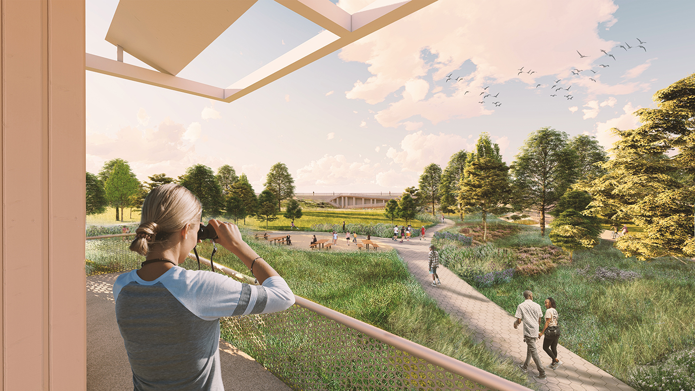
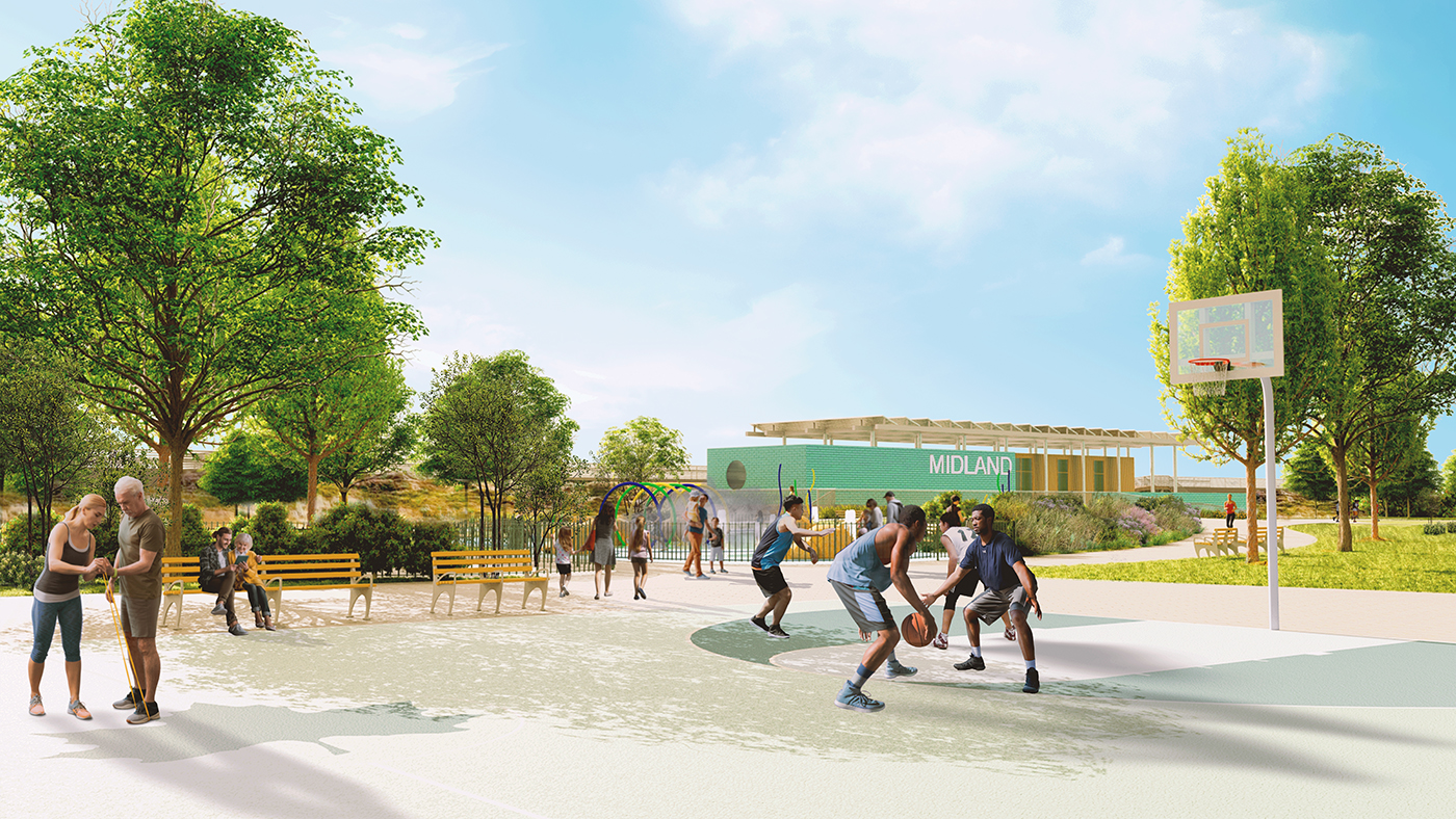
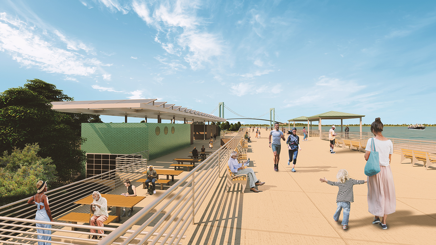
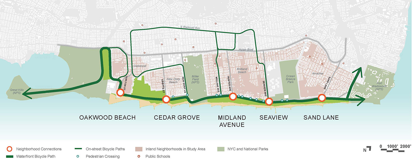
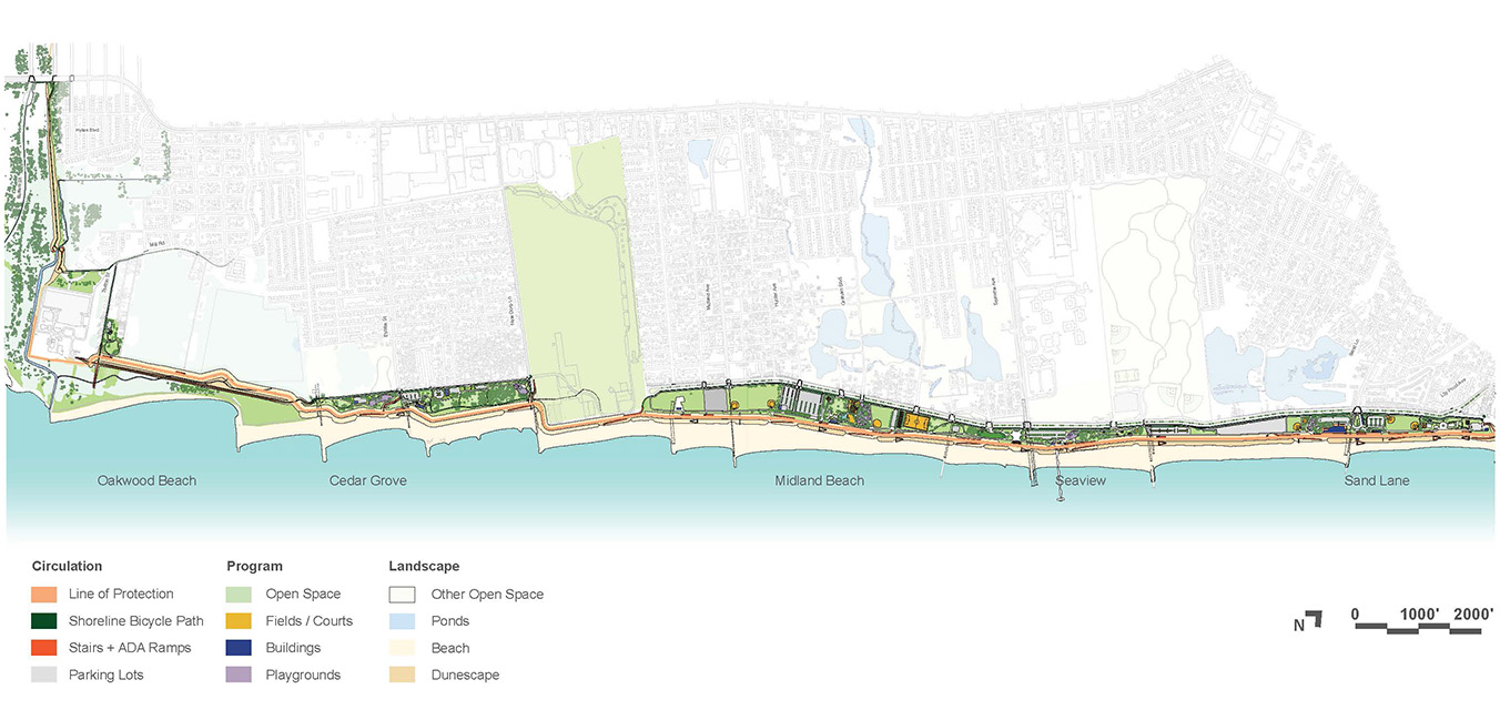
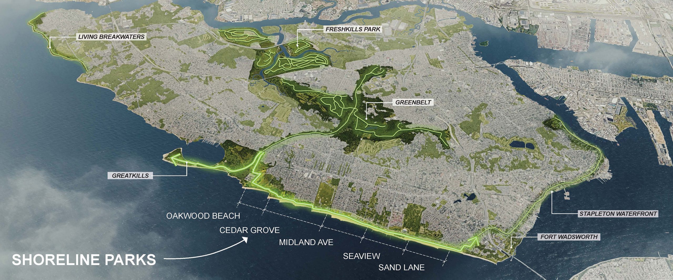
The Shoreline Parks Plan focuses on the Staten Island Waterfront Greenway and six natural and recreational areas within NYC Parks properties on Staten Island’s East Shore. NYC Parks commissioned this concept plan to develop approaches for integrating NYC Parks shoreline assets with the construction of the U.S. Army Corps of Engineers (USACE) flood protection system. This federally-funded “Line of Protection” (LOP) is a five-mile seawall and levee to mitigate coastal flooding from hurricanes in Staten Island. USACE’s project created the basis for reconceptualizing many waterfront open spaces into a comprehensive shoreline plan with diverse ecologies, mobility options, and recreational opportunities accessible to all. The concept plan features a continuous bicycle path and five “neighborhood connections.” Each connection is re-imagined around a unique theme, creating a gradient from natural to civic experiences south to north along the shore. The concept plan addresses inclusion and accessibility, resilience, and long-term operations and maintenance. Leading the consultant team, Starr Whitehouse supported NYC Parks with concept planning, public engagement, and coordination with other NYC public agencies.
Category